Dubai Canal Cycling: Waterfront Route, Map & Facts
Key facts
- Canal length
- 3.2 km of water, Dubai Creek at Business Bay to the Gulf at Jumeirah
- Mapped paths
- ≈11.4 km mapped on the south bank (promenade and Canal Walk levels combined) · ≈0.5 km mapped on the north bank
- Surface
- Paved waterfront promenade, flat throughout
- Separation
- Shared promenade: walkers, joggers and scooters use the same space
- Hours & cost
- Free · open 24 hours · bridges and waterfall lit at night
- Crossings
- Footbridges only, incl. the Tolerance Bridge; each bank is a separate ride between crossings
- Metro access
- Business Bay station (Red Line) is a short walk from the east end
- Connections
- West end joins the Jumeirah coastal track at Jumeirah Street
Verified against the sources below (desk research, field ride pending). Rows marked “field check pending” publish as facts only after we ride and confirm them.
The Dubai Water Canal is a 3.2 km man-made waterway from Business Bay to the sea at Jumeirah, with a flat, paved promenade along both banks that is open to cyclists around the clock and free to use. The two banks are separate rides: there is no crossing at water level, so you switch sides only at the footbridges, including the Tolerance Bridge with its dedicated walking and cycling deck. At the canal mouth the promenade connects to the 16 km Jumeirah coastal track, and Careem BIKE docks serve the Canal, City Walk and Business Bay.
The route
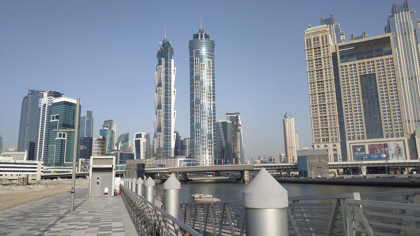
The canal gives Dubai a genuine waterfront ride through the middle of the city: 3.2 km of water cut from the Creek at Business Bay to the open sea at Jumeirah, inaugurated in November 2016, with a flat, paved promenade along the banks. Ridden west, the scenery runs from the Business Bay towers, under the Sheikh Zayed Road bridge with its mechanical waterfall, past Safa Park and the villas of Jumeirah, to the canal mouth by the beach. Treat it as two rides, not one: the banks never meet at water level, so each side is its own out-and-back between bridge crossings, and a loop using two footbridges is the natural way to see both. On our live map the south bank carries most of the mapped riding, about 11 km of promenade and Canal Walk paths across its levels, while the north bank currently shows only a short mapped fragment; we suspect thin map coverage rather than a missing path and are checking it in the field. At the mouth, the promenade hands you straight onto the 16 km Jumeirah coastal track, which is what turns a short canal spin into a proper seafront ride.
Crossing between banks
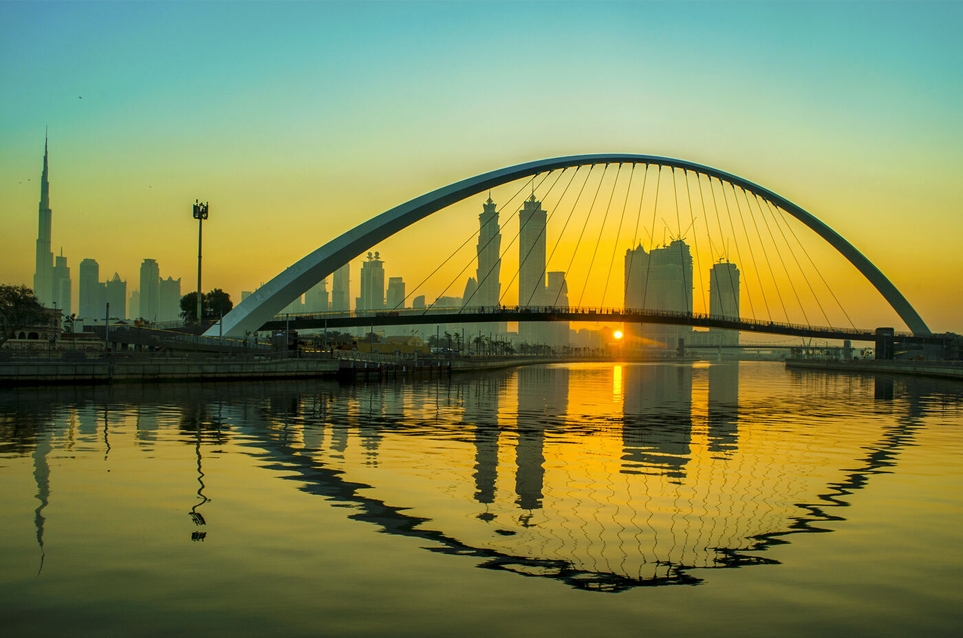
Three dedicated footbridges span the canal, in addition to footpaths on the three road bridges (Sheikh Zayed Road, Al Wasl Road and Jumeirah Road), all built high enough for boats to pass beneath. The signature crossing is the Tolerance Bridge near Safa Park: a clear-span suspension bridge, the first of its kind in the Middle East, carrying a 690-foot walking and cycling path with the best Burj Khalifa skyline view on the route. The footbridges and the waterfall are lit after dark, which makes an evening bank-to-bank loop one of the better night rides in central Dubai. Plan your crossing before you need it: because the banks are separate rides, a missed bridge means backtracking, and the gaps between crossings are long enough to matter on a short ride. We are field-checking which footbridges have full ramps and which rely on stairs or lifts, since that decides how freely you can loop with a bike.
Getting there, parking & bike share
The east end is the easy arrival: Business Bay metro station (Red Line) is a short walk from the canal, and Burj Khalifa/Dubai Mall station also works for the north bank. Remember the metro's bicycle rules: folding bikes are allowed aboard, full-size bikes are restricted. Driving, there is parking near the canal and under the Sheikh Zayed Road bridge; we are still mapping which car parks work best for riders at each end. Arriving empty-handed is genuinely practical here: Careem BIKE added docking stations across City Walk, the Dubai Water Canal and Business Bay (22 stations across five Dubai Holding communities), so a share bike covers the promenade comfortably within a rental window. Rental shops also operate along the canal for longer sessions. For drop-bar bikes and open road, hire at Al Qudra instead and keep the canal for the slow ride.
What riders should know
Rider knowledge: community consensus (local guides and rider write-ups), not official RTA information.
This is a shared promenade, not a cycle track, and the ride is best when you accept that. Evenings and winter weekends fill the waterfront with walkers, joggers, families and e-scooters, and the restaurant frontages around Business Bay demand walking pace; early morning flips it completely, with an empty promenade and the waterfall bridge to yourself. Keep your speed civil, give pedestrians the benefit of every doubt, and remember Dubai's helmet and light rules apply on city paths, see our rules page. The canal's real value to a cyclist is as a connector: it is the flat, traffic-free line between Business Bay and the sea, and from the mouth the Jumeirah coastal track continues 16 km up the beach, so canal plus coast makes a satisfying half-day city ride. Heading the other way, the Business Bay end points you toward the Creek and Ras Al Khor, though we have not yet verified a continuous riding line east of the canal. For training, look elsewhere: Nad Al Sheba is ten minutes away and built for it.
FAQ
Can you cycle along the Dubai Water Canal?
Yes. A flat, paved promenade runs along the canal between Business Bay and the sea at Jumeirah, and it is open to cyclists, free, around the clock. It is a shared space with pedestrians and joggers rather than a dedicated cycle track, so ride at a civil pace.
How long is the Dubai Canal cycling route?
The canal itself is 3.2 km of water, so one bank is roughly a 6 to 7 km out-and-back. Our live map measures about 11 km of paths on the south bank across its promenade levels. Linking the canal mouth onto the 16 km Jumeirah coastal track makes it a much longer ride.
Can you cross from one bank to the other?
Only at the bridges. Three footbridges span the canal, including the Tolerance Bridge with its 690-foot walking and cycling deck, and the three road bridges carry footpaths too. Between crossings each bank is a separate ride, so plan your loop around the bridges.
Is the canal path free and open at night?
Yes. The walkway, bridges and cycling paths are free to access and open 24 hours, and the footbridges and the Sheikh Zayed Road waterfall are lit after dark. (Source: MyBayut.)
Can I rent a bike at the Dubai Canal?
Yes. Careem BIKE docking stations serve City Walk, the Dubai Water Canal and Business Bay, and rental shops operate along the canal. For serious road bikes, rent at Al Qudra instead.
Is the Dubai Canal good for training rides?
No, it is a leisure ride and a connector. Crowds and shared space cap your speed. For uninterrupted training use Nad Al Sheba's floodlit loops or the Al Qudra desert network, both on this site.
More Dubai tracks
Al Qudra Cycle Track
The flagship desert network: 50 km main loop, vehicle-free, sunrise territory.
Nad Al Sheba Cycle Park
Dubai’s 24-hour floodlit cycle park beside Meydan: 4, 6 and 8 km loops.
Jumeirah Coastal Track
16 km of free beachfront riding past Kite Beach and the Burj Al Arab.
Kite Beach Cycling Track
The beachside stretch of the Jumeirah track: showers, food trucks and the Burj Al Arab in frame.
Mushrif Park MTB Trails
Dubai's in-city mountain-bike park: 50 km of graded singletrack under the ghaf trees.
Dubai Marina & JLT Cycle Track
City riding between the towers: ~11 km of connected waterfront and lakeside lanes.
JLT Cycling Track
Lakeside loops around the towers: about 7 km of short lanes and promenades stitched into one easy ride.
Al Sufouh Cycle Track
The tram-corridor link: ~14 km connecting Dubai Marina to Madinat Jumeirah past the Palm gateway.
Al Quoz Cycle Lanes & Pond Park
Two mapped lane corridors and a pond-side park in Dubai's industrial arts district.
Dubai Hills Cycling Track
Green-community riding: ~7 km of lanes along the boulevard and park edge of Emaar's flagship estate.
Arabian Ranches Cycling
Suburban family riding: ~43 km of community paths across Arabian Ranches, Al Barari and Wadi Al Safa.
Hatta MTB Trail Centre
The Middle East's first MTB trail centre: 50+ km of graded mountain singletrack.
Meydan Cycle Track
The track that became Nad Al Sheba: Meydan's famous loops, alive and renamed.
DXBike: District One Cycle Track
Dubai's branded everyday track at Meydan, and how it differs from Dubai Ride.
The Loop: Dubai's 93 km Cycling Highway
The climate-controlled cycling superhighway Dubai talked about, and where it actually stands.
Me'aisem Cycle Loop
A quiet ~9 km community loop around Dubai Production City, far from the tourist tracks.
Expo City & DIP Cycle Tracks
Two separate roadside stretches at Dubai's southern edge: ~6 km along Expo Road and ~4 km inside Dubai Investments Park.
Ras Al Khor Cycle Lanes & Flamingo Sanctuary
A quiet district lane grid with Dubai's flamingo wetland as the ride's destination.
Al Warqa & Mirdif Cycle Track
Eastern Dubai's neighbourhood ride: ≈8 km of community lanes between the villas, next door to Mushrif Park.
Al Wathba Cycle Track
Abu Dhabi's answer to Al Qudra: five desert loops up to 30 km, lit for night riding.
Hudayriat Island Cycle Track
Abu Dhabi's sports island: lit road loops, a graded MTB park, and a track over the sea.
Al Ain Cycle Track
The Garden City's 23 km loop: free, 24/7, with Jebel Hafeet's great climb next door.
Yas Marina Circuit: TrainYAS
Ride the actual F1 circuit: free, floodlit, with free bikes to borrow.
Sharjah Cycling Tracks: Al Batayeh & Masaar
A 24 km bicycle-only desert ribbon and a 6.6 km forest loop: Sharjah rides two ways.
Abu Dhabi Corniche Cycle Path
Eight flat kilometres of waterfront: the capital's easiest, easiest-to-rent ride.
Bike Rental in Dubai
Every way to rent a bike in Dubai: share docks, track fleets, carbon road bikes, beach cruisers.
Dubai & UAE Cycling Events
Every ride you can enter this season: from the SZR takeover to UCI qualifiers.
Or see every dedicated track at once on the live map. Before you ride: the Dubai cycling rules & fines (helmet and vest are legally required), the verified network stats, and the full guide to cycling in Dubai.
Sources
- Wikipedia: Dubai Canal
- MyBayut: complete guide to Dubai Canal
- Dubai Media Office: RTA opens 16 km cycling track at Jumeirah Beach
- Careem: new Careem BIKE stations
- Dubai Travel Guide: Dubai Water Canal
- Provident Estate: Dubai Water Canal guide
- PinoyBuilt: Tolerance Bridge, Dubai Water Canal
- Komoot: Tolerance Bridge highlight